
Ecuador: Capturing Vanishing Ice on the Equator
On a mission to document vanishing ice across the globe, I found myself in Ecuador back in February — a South American nation named for its position on the Equator. You may wonder why I’m chasing ice on the Equator, but Ecuador is home to Andean peaks towering up to 6,310 metres. It turns out that the country’s stratovolcanoes are home to a number of receding glaciers.
I arrived in Quito with a friend and fellow photographer, Kris Andres. An assault on all the senses, Quito was as colourful, bustling, and stimulating as I imagined. We hiked to the summit of Volcán Pichincha (4,800 m) to acclimatize for the higher elevations we planned to reach. Having spent time at elevation in Africa and Nepal, I acclimatized rather well.
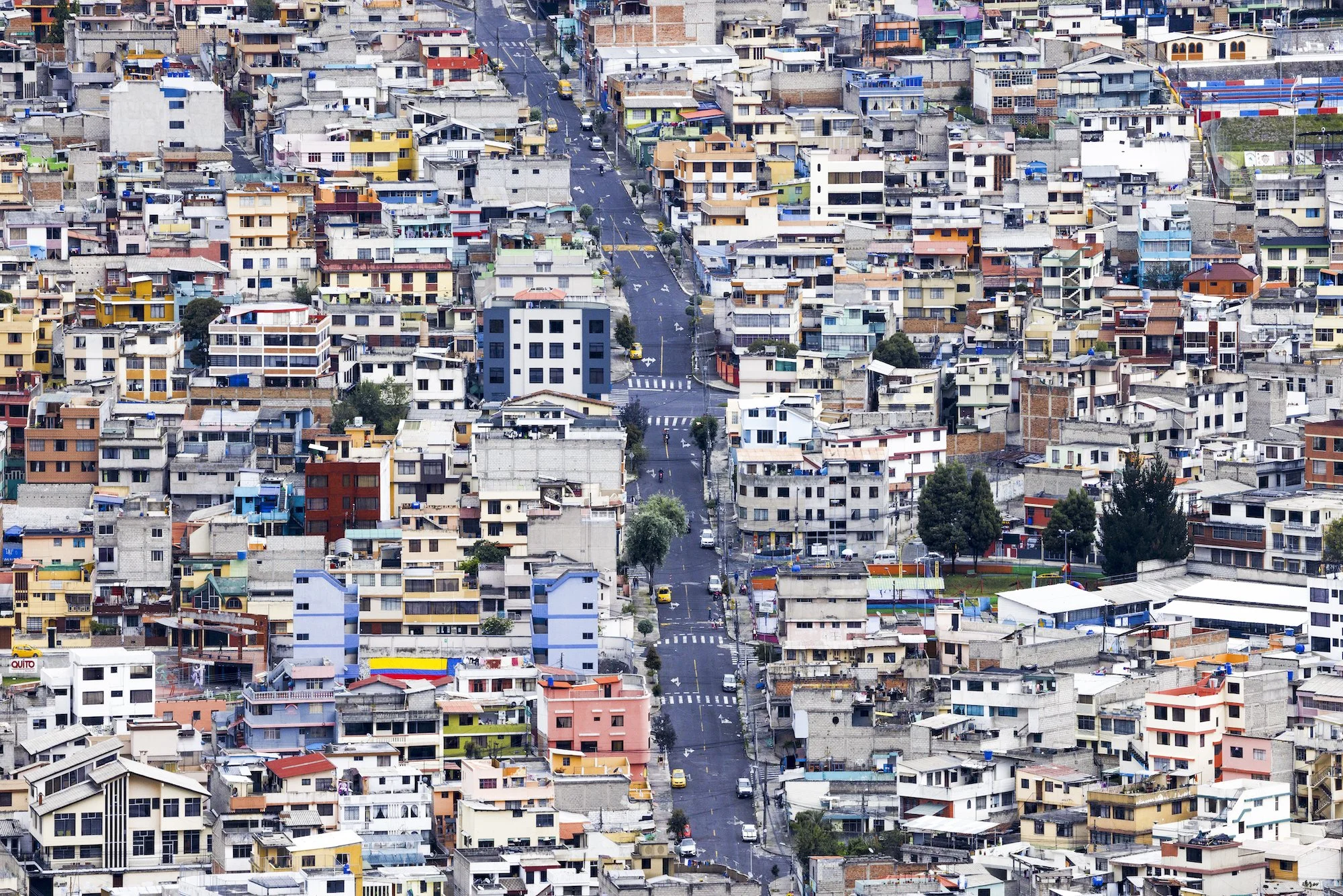
Colourful and bustling Quito. Photo by Paul Zizka.
Quito is surrounded by hills and highlands, which we were eager to explore. It wasn’t long before we were en route to our next objective: Volcá Illiniza Norte (5,126 m). We set off around midnight in light snow, guided by the light of our headlamps. Conditions were challenging due to the build-up of ice and rime from the previous day’s storm. We couldn’t see anything when we reached the summit but just as we were about to pack up, everything opened up. It was absolute magic and everything I could wish for as a photographer: brilliant side light, dynamic clouds, and Illiniza Sur (5,245 m) rising in the background. In terms of scenery and photography, that fifteen minutes was the highlight of the entire trip.
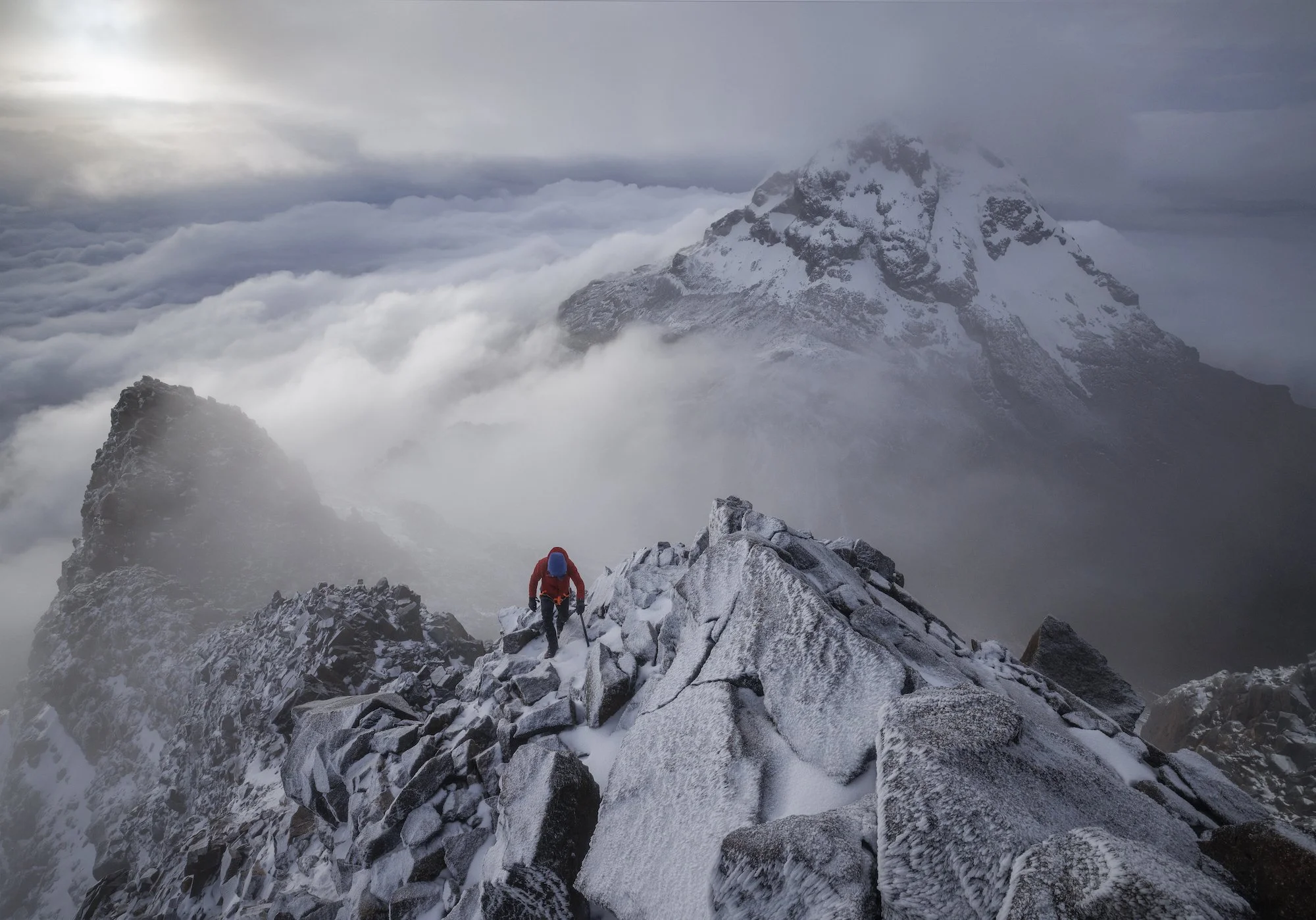
Clouds parting momentarily on the summit of Volcan Illiniza Norte. Photo by Paul Zizka.
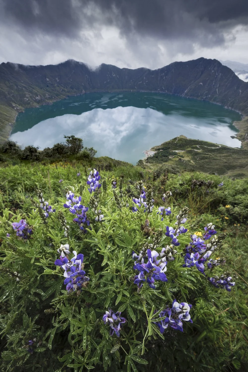
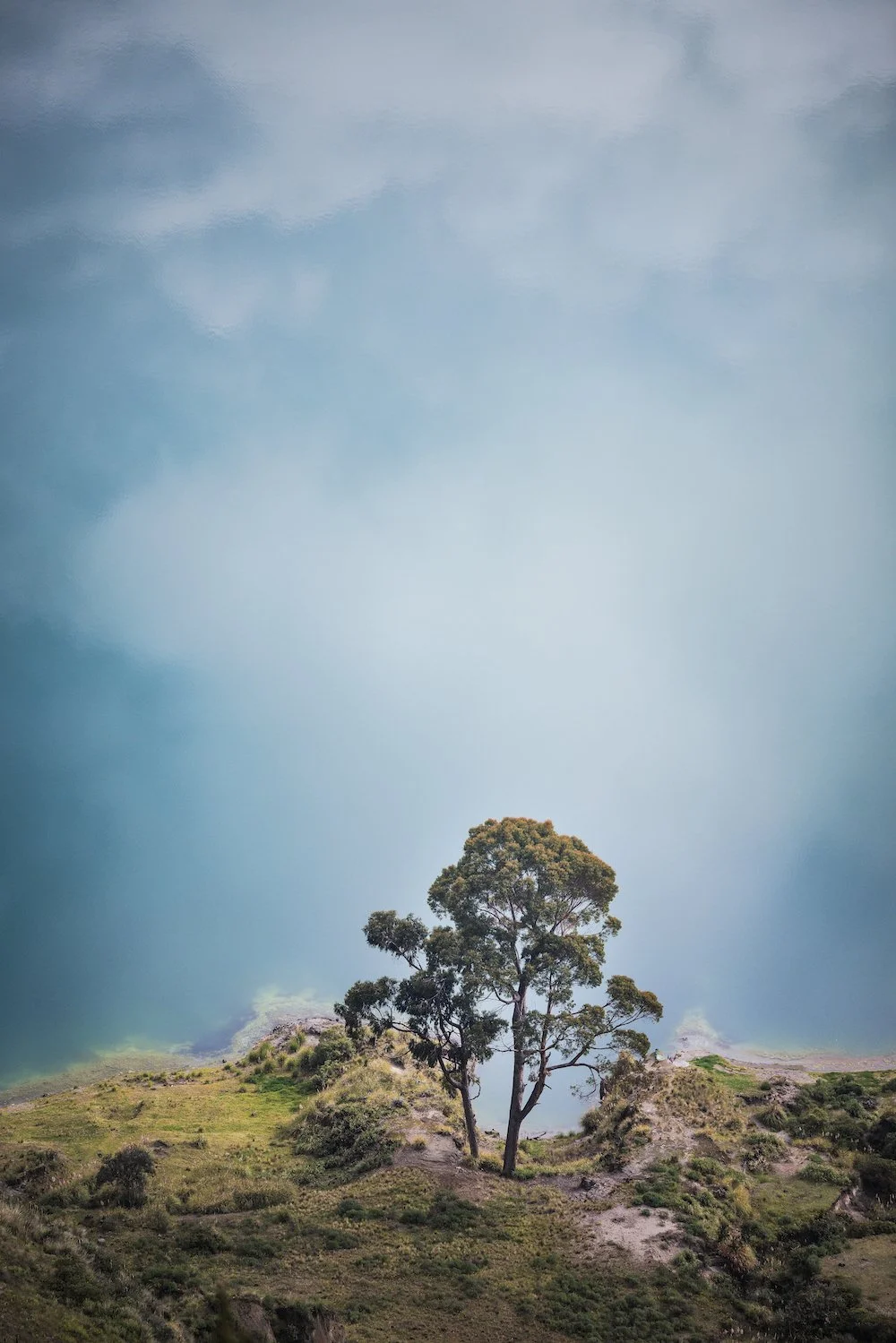
That’s not to say that the rest of our time in Ecuador wasn’t absolutely mind-blowing. Following Illiniza Norte, we hiked into the Jose Ribas refuge by circumventing the Quilotoa Crater. We spent half a day walking on the rim of a vast volcano, immersed in scenery that was unlike anything I’d ever seen before. Quilotoa is much older than the two previous volcanoes, geologically speaking. The landscape is also incredibly lush and vibrant. Traversing such different terrain was a refreshing intermission before our biggest climb.
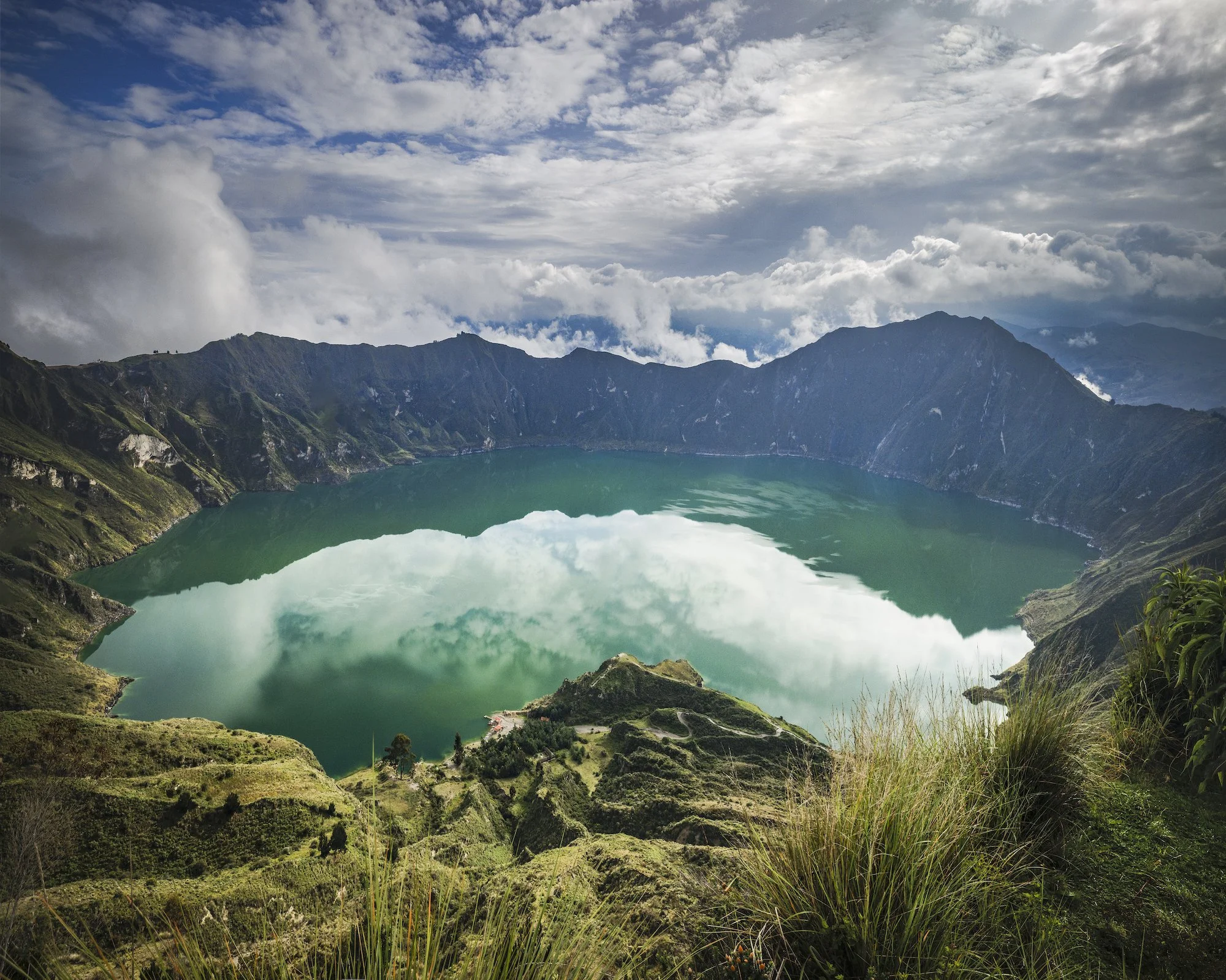
Quilotoa Crater. Photo by Paul Zizka.
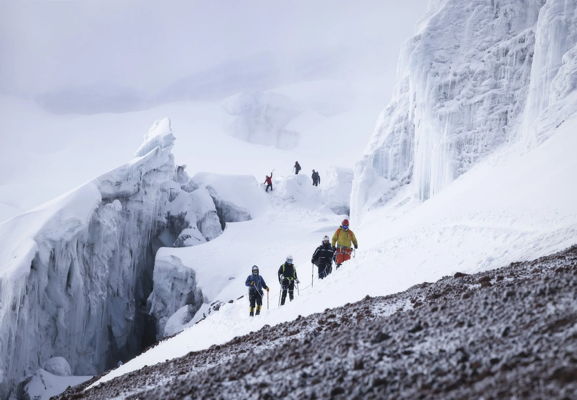
The pinnacle of our trip was Volcán Cotopaxi (5,897 m) located about 50 km south of Quito. We stayed at Tambo Paxi at the base of the volcano, got up to shoot the sunrise, then drove all the way up to a shelter that sits at an elevation of approximately 5000 metres. We got some rest but were up at 11 pm for a midnight start. With a new moon, we could only see as far ahead as our headlamps allowed. A billion stars glimmered overhead and Quito’s lights were visible in the distance. We wove our way through seracs towards the summit. Clouds rolled in halfway up, which was unfortunate for photos but added to the atmosphere.
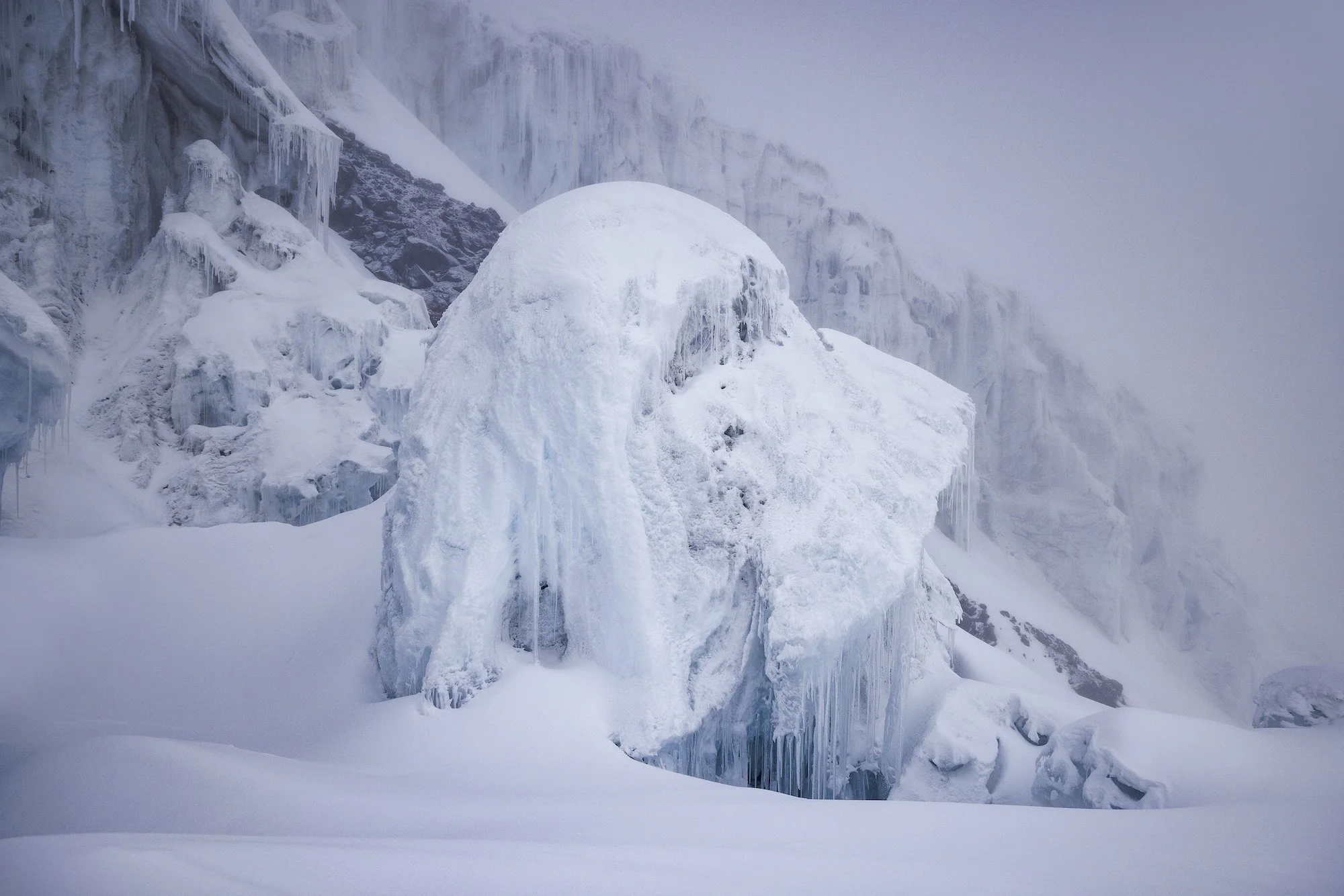
We topped out on the edge of a giant summit crater. Eventually, other rope teams arrived at the summit of Cotopaxi. The clouds didn’t part until we were halfway down, revealing distant volcanoes and volcanic plains. The descent was magical and made for some great photo opportunities and some of my favourite images from the trip.
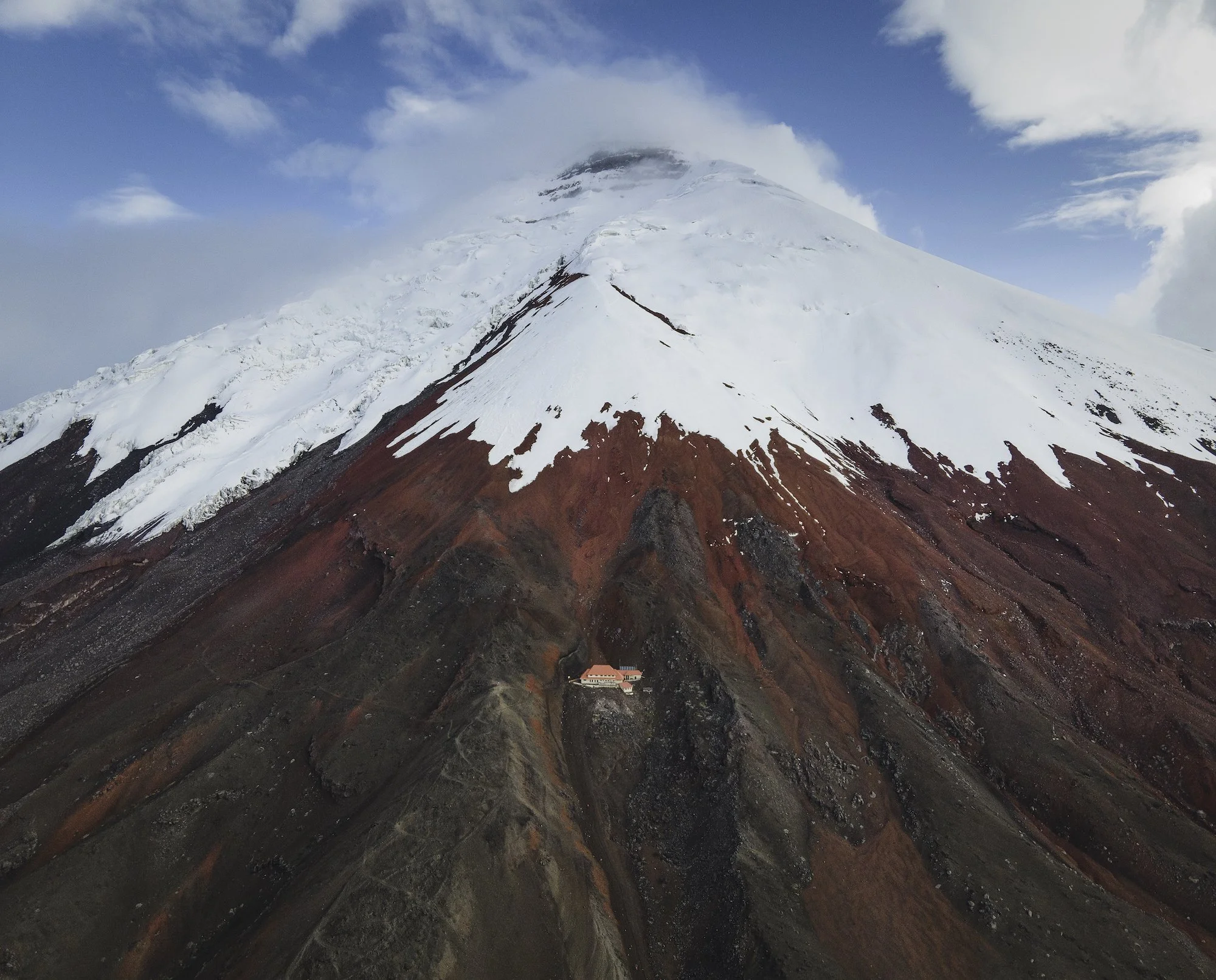
The Cotopaxi Refuge. Photo by Paul Zizka.
This trip to Ecuador was a wonderful opportunity for me to observe a new landscape, experience a new culture, and document rapidly changing glaciers that sit high up on the Equator. The trip came with its own challenges, like shooting in a highly dynamic environment that’s constantly changing. With volcanoes attracting and shedding weather quickly, I had to be on the ball to make the most of brief windows of opportunity. Overall, It was unbelievable to climb ice so close to the equator and gaze into distant coastal areas and jungles from a high altitude. The trip ultimately revealed that Ecuador is full of kind people and offers a ton of variety despite being such a small country. I certainly look forward to returning someday!
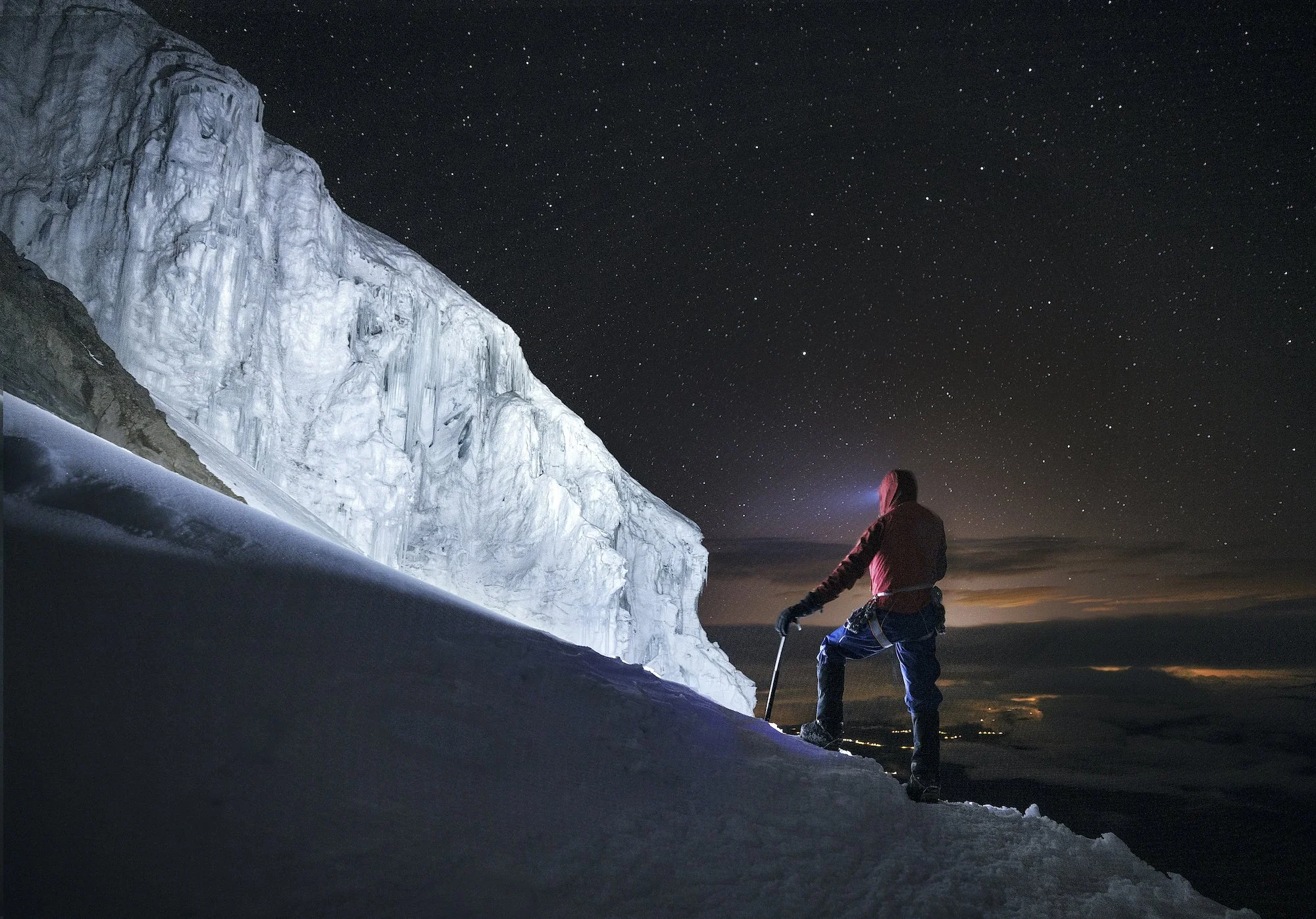
Weaving through seracs on our ascent of Cotopaxi. Photo by Paul Zizka.